
Effingham, IL-(Effingham Radio)- After months of dry conditions, we finally have a few days straight of rain in the forecast.
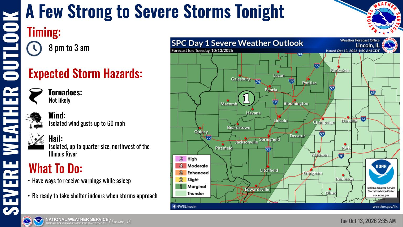
A Level 1 risk of severe weather remains in place for tonight, generally in areas west of I-57. Isolated damaging wind gusts are the main concern, though a few storms northwest of the Illinois River may also contain large hail. The most likely time for any severe weather will be after 8 pm, continuing past midnight.
A front is expected to become stationary over central Illinois later today, lingering for a few days. This will result in periods of showers and thunderstorms beginning tonight and continuing into Thursday night, with the longest dry period most likely north of I-72 Wednesday and Wednesday evening. By the end of the work week, highs in the upper 50s and lower 60s will be common.
Photo & Story Courtesy of NOAA







Comments