
 Effingham, IL-(Effingham Radio)- We have a chance for some severe weather tonight.
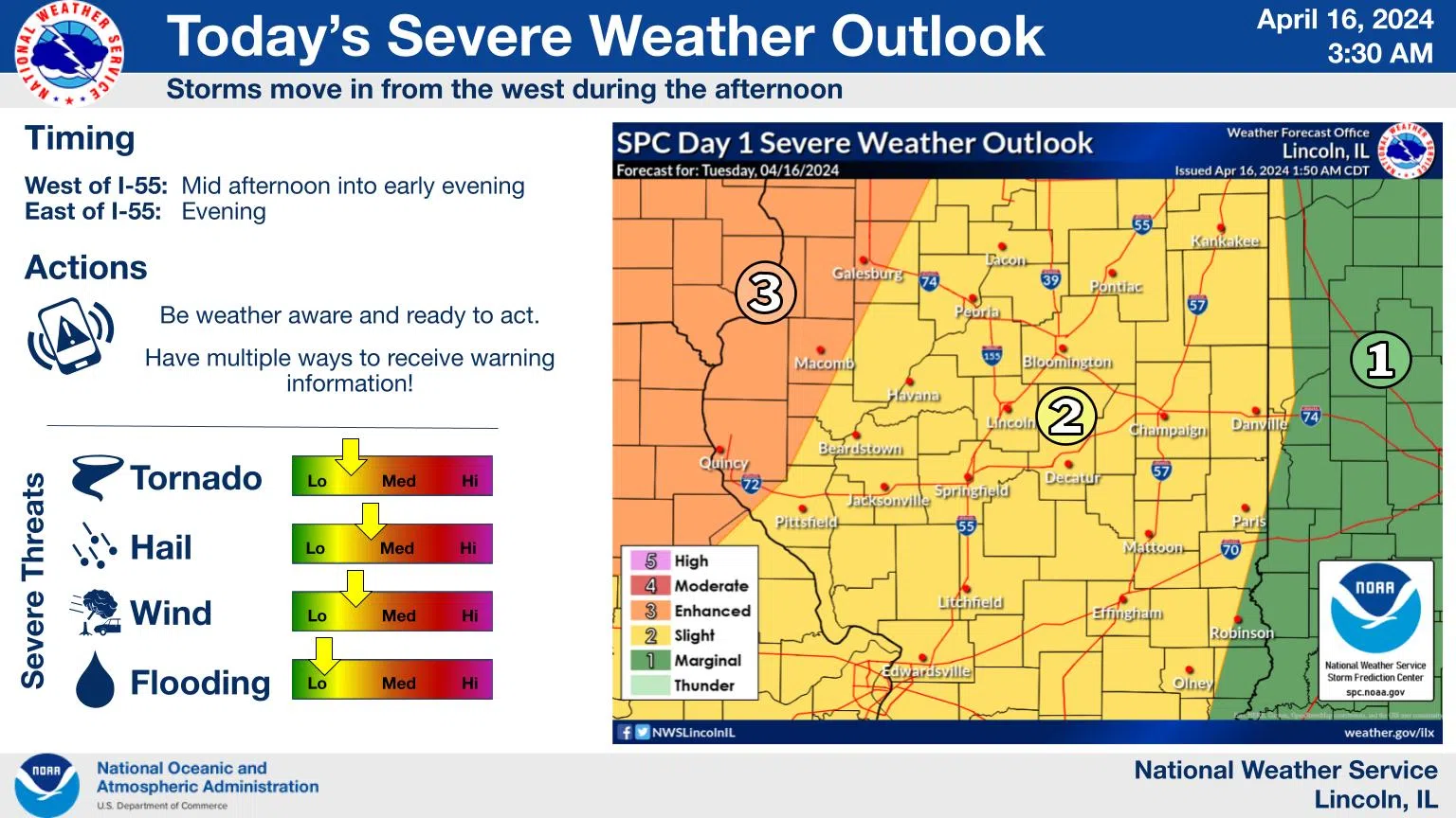
The latest outlook from the Storm Prediction Center maintains a Level 3 risk of severe weather in parts of west central Illinois for today, though not as far east as previously (staying west of the Illinois River). A Level 2 risk continues elsewhere. The main time frame for any severe weather will be mid to late afternoon west of I-55, and beginning early evening near and east of I-55. Large hail, damaging winds, and a few tornadoes are all possible.
Rainfall amounts should not be excessive (generally less than half an inch). The best chances of seeing around an inch will be northwest of Peoria and Havana. South winds gust to around 35 mph today, and similar speeds are expected out of the west on Wednesday. While temperatures cool off some from what we’ve had the last few days, it won’t be until Friday before a more substantial cooling trend takes place.
Keep an eye on the weather today, and be prepared to seek shelter as storms approach.


Comments