
Effingham, IL-(Effingham Radio)- The excessive heat that has been with us for a couple weeks is finally giving way to much cooler conditions tonight.
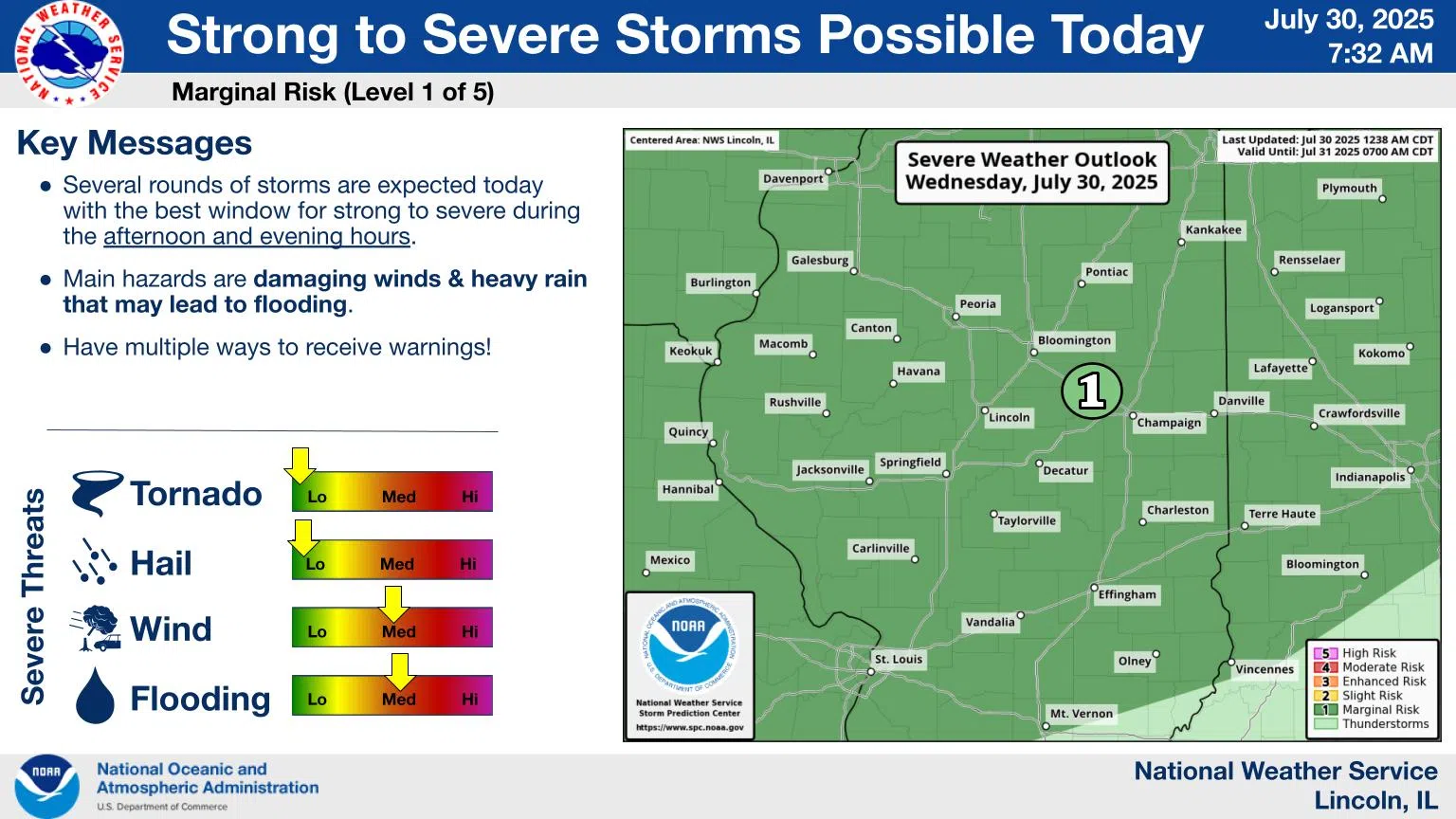
Periods of storms will be common today, with a few strong to severe storms possible this afternoon into evening. A line of showers and storms will track east at 30 mph, affecting much of central IL into early afternoon. Expect heavy downpours, frequent cloud to ground lightning, and isolated 30-50 mph wind gusts.
Gusty winds will be common with these storms. Isolated wind damage is possible. High rainfall rates will bring a risk of flash flooding.
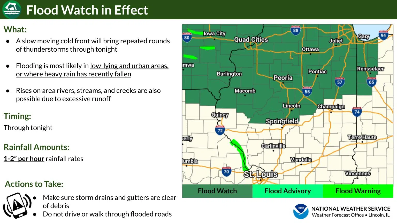
Repeated rounds of storms could result in flooding of low-lying and urban areas, or where heavy rain has recently fallen. A Flood Watch is in effect for a handful of counties in central Illinois through tonight.
Additional chances for storms will bleed into Thursday, with the highest chances being over southeast Illinois. Hot and humid weather will be replaced by cooler and less humid conditions beginning Thursday.
Photos & Story courtesy of NOAA


Comments