
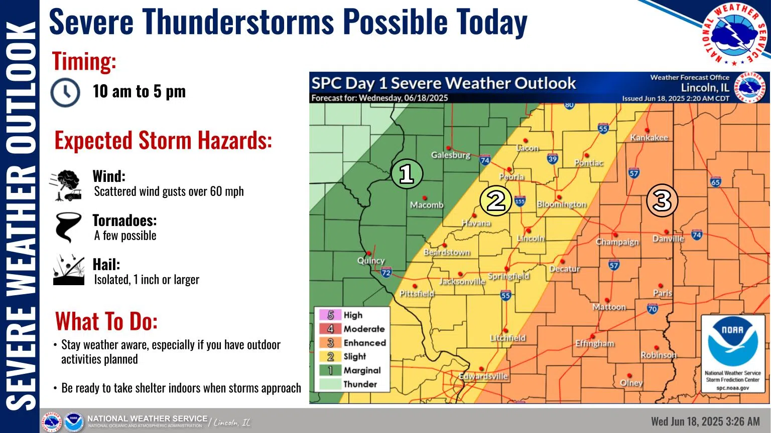
Effingham, IL-(Effingham Radio)- Severe weather is likely today, bringing with it a chance for damaging winds, hail, and possibly a few tornadoes.
There is a risk of severe thunderstorms from mid morning through late afternoon today across central and southeast Illinois, especially east of I-55 where there is an Enhanced, or level 3 of 5, Risk for severe storms. The primary severe weather threat is scattered wind gusts over 60 mph, however a few tornadoes and isolated large hail are possible as well. Severe weather threats look to begin around 10 AM as a disturbance moves into the area, and diminish after 5 PM.
Temperatures will cool off a few degrees for today and Thursday with highs from the upper 70s to mid 80s. More oppressive heat and humidity will develop for the weekend, as highs rise into the lower to mid 90s and heat index approaches 105 degrees.
Photo & Story courtesy of NOAA


Comments