
Effingham, IL-(Effingham Radio)- We have a chance for severe weather the next two days, with hot and humid conditions will sweep the area by the weekend.
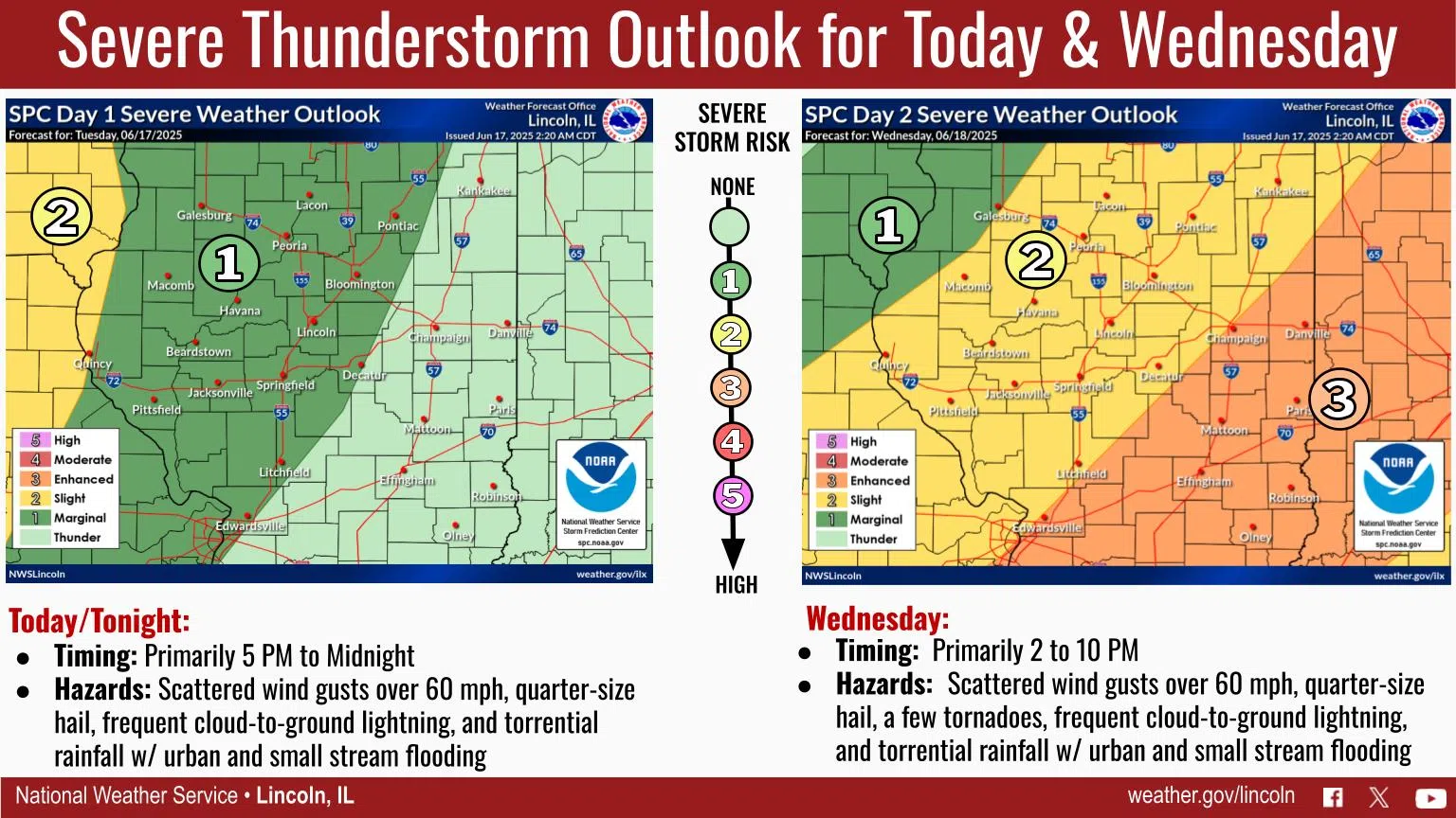
Increasing risk for severe thunderstorms can be expected tonight into Wednesday as a cold front approaches and moves through the area by Wednesday night. The main severe weather threats will be locally damaging wind gusts over 60 mph and quarter-size hail both this evening and Wednesday, however a few tornadoes are also possible Wednesday. Frequent lightning and locally heavy rainfall that could produce urban and small stream flooding are threats as well.
Timing continues to be somewhat uncertain both days as the location for initial thunderstorm development continues to have low predictability, however timing looks to be most likely from around 5 PM to midnight today, and 2 PM to 10 PM for Wednesday. For today and tonight, any severe weather looks to remain west of I-57, but Wednesday a the entire state has a severe thunderstorm threat.
Oppressive heat and humidity will overspread the region this weekend. Take precautions to stay safe!
Photo & Story Courtesy of NOAA


Comments