
 Effingham, IL-(Effingham Radio)- The forecasted severe weather is now more likely for our immediate listening area.
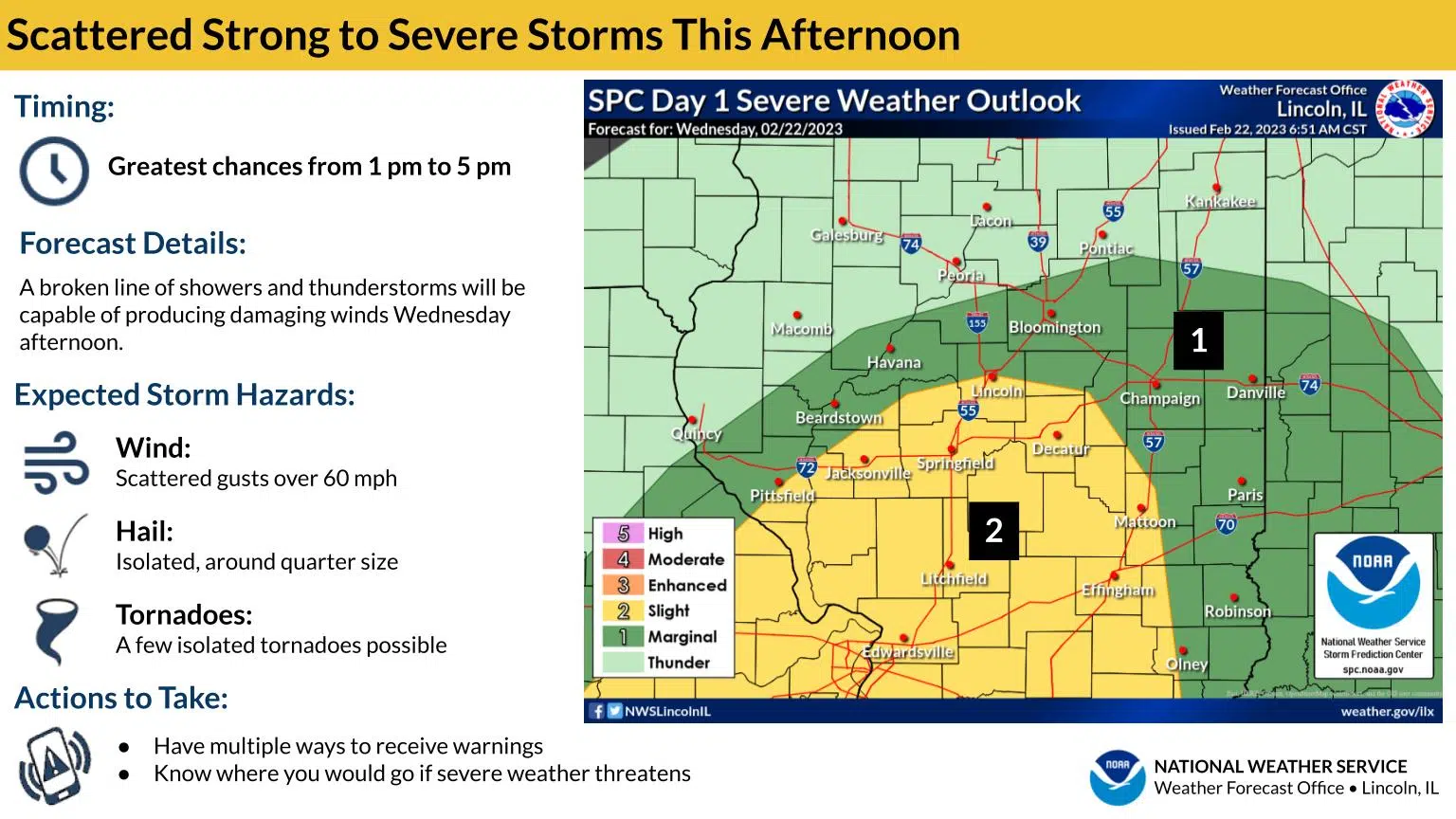
As a line of thunderstorms moves across central Illinois this afternoon, some may be strong to locally severe. The highest chance of this occurring (threat level 2 of 5) is in the yellow shaded areas of the map. Damaging winds are the primary concern from these storms. Isolated large hail is also a possibility, mainly north of I-70, and a few tornadoes cannot be ruled out.
There is also a wind advisory in effect for two of our neighboring counties to the south and east, and extends southeast.
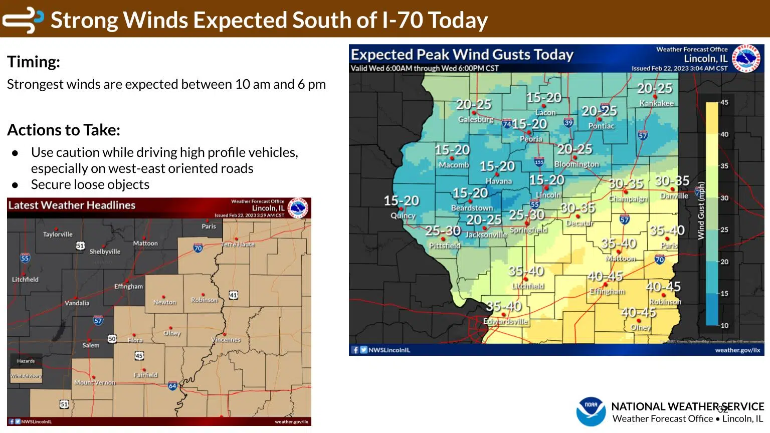
South winds will gust from 40 to 45 mph late morning through the afternoon hours today, impacting areas south of I-70. Some travel difficulties are likely for high profile vehicles on west-east oriented roadways.
After the storms move through, the temperatures will begin to fall.
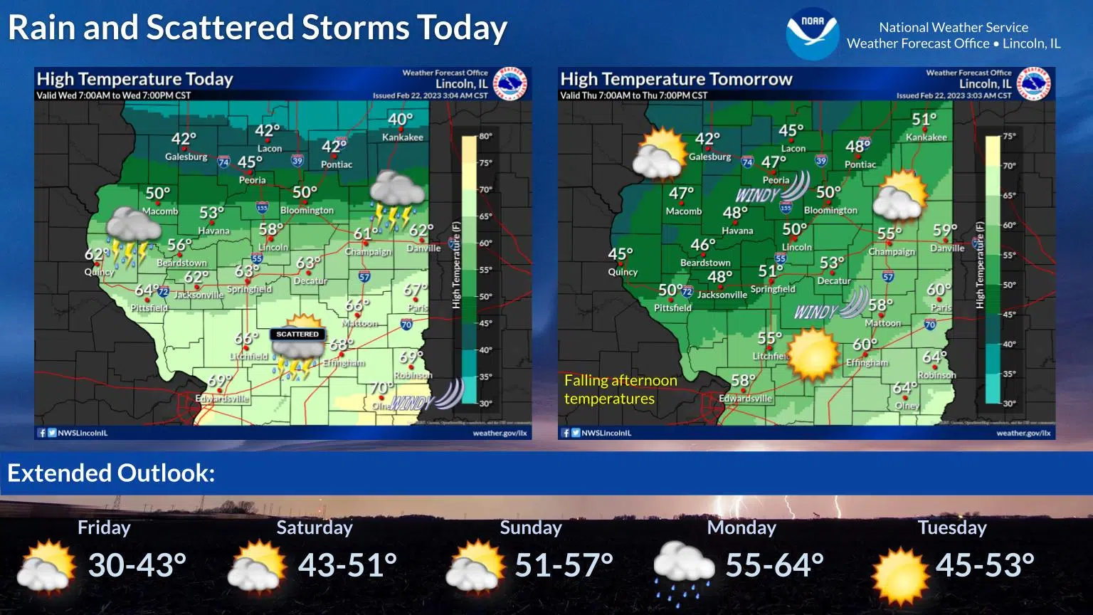
With a warm front hanging out across central Illinois today, expect a wide range in temperatures. Areas north of there will only see highs in the 40s, while those to the south soar well into the 60s. Rain and thunderstorms will be most widespread north of this front. On Thursday, most areas will see high temperatures occur in the morning, as the parent storm system moves through and brings colder air to the region.
Photos Courtesy of NOAA


Comments