
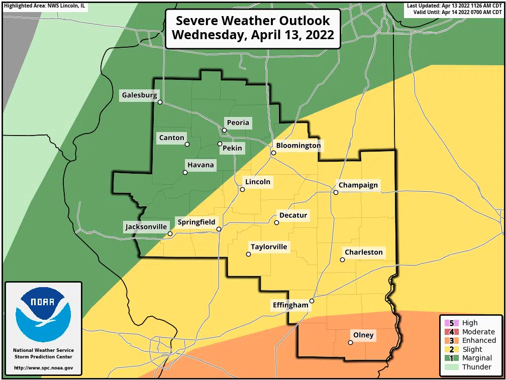
 Effingham, IL-(Effingham Radio)- The National Weather Service in St. Louis has updated their forecast and now says the greatest threat for severe thunderstorms has shifted southeast into southeast Missouri and southern Illinois. The timing continues to track the same, with storms entering southeast Missouri and southern Illinois during the afternoon. The primary threat with thunderstorms that become severe will be damaging winds and a possible tornado.
Official Release from the National Weather Service:
This Hazardous Weather Outlook is for east central and southeast Illinois:
DAY ONE – Today and tonight:
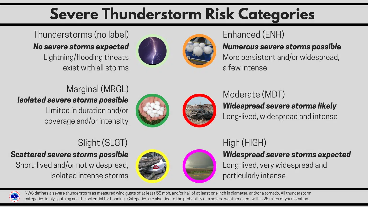
- Thunderstorms will be scattered this morning, before becoming more numerous. The storms in the afternoon and evening will likely be severe. Damaging winds, potentially in excess of 70 mph, large hail, and tornadoes are all possible. In addition, the storms may cause localized flooding.
DAYS TWO THROUGH SEVEN – Thursday through Tuesday:
- Southwest winds will gust from 30 to 35 mph on Thursday in areas north of I-70, with the highest speeds near I-74. Minor flooding may develop along the Wabash and Little Wabash Rivers late this week.
*Pictures courtesy of National Weather Service in Lincoln*


Comments