
Photos courtesy of the National Weather Service in Lincoln
 EFFINGHAM, IL-(Effingham Radio)- “Round Two” of Winter Weather is expected to affect our area, following a Winter Storm that moved through the area last weekend.
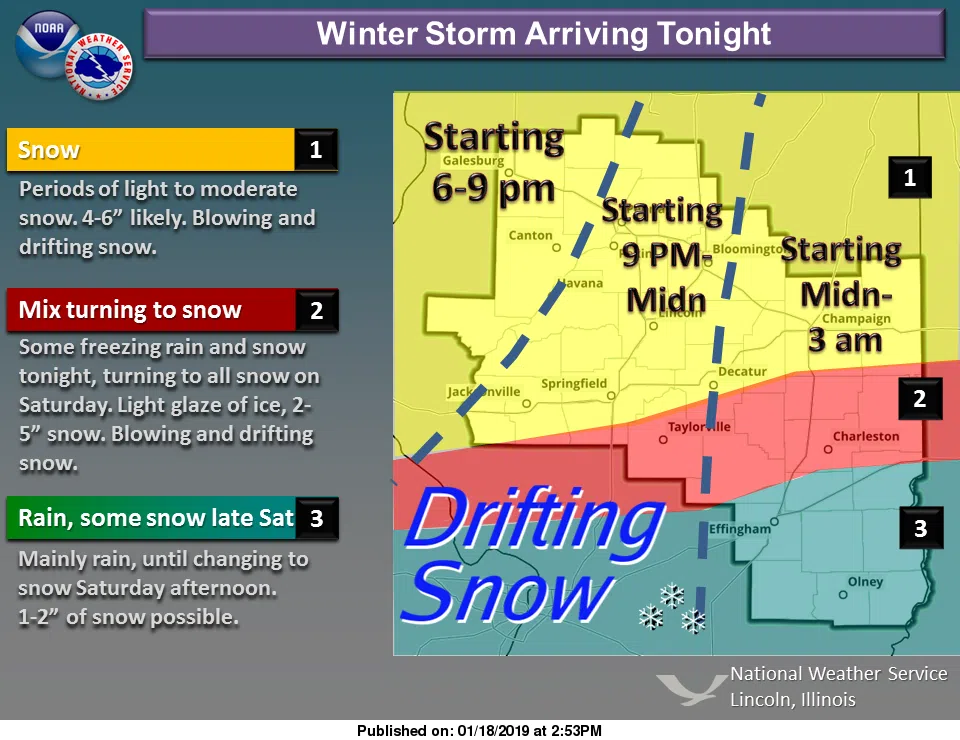
According to the National Weather Service in Lincoln, a Winter Storm is expected to move into Central Illinois tonight and last through tomorrow evening.
While there is expected to be a wide variability in snow totals across Central Illinois, it will likely be difficult to measure snow totals due to strong northerly winds gusting up to 40mph in the area tomorrow.
These winds will create travel impacts, as well, with blowing and drifting snow reducing visibility to whiteout or near whiteout conditions.
Our listening area to the North of I-70 is expected to see a mix of freezing rain and snow tonight, changing to all snow tomorrow.
Mainly rain is expected to our listening area to the south of I-70 until Saturday afternooon, when snow is expected to develop and produce 1-2 inches in accumulation.

Photos courtesy of the National Weather Service in Lincoln
According to the National Weather Service, “Current expectations are for most of the area north of a line from Taylorville to Danville to receive an average of 4 to 6 inches of new snowfall, with 2-4″ in the corridor from Mattoon to Paris, and 1-3″ south of there with locally higher amounts possible.”
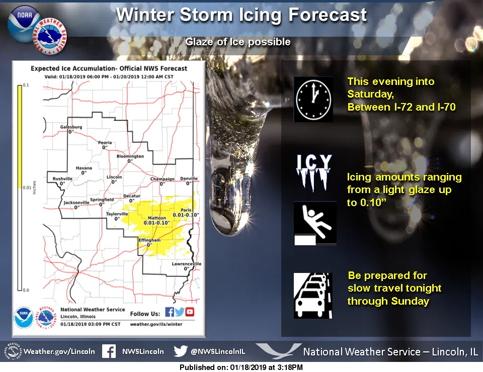
Additionally, the National Weather Service is stating that while icing should not be a significant portion of this Winter Storm, any icing can add to the hazardous travel conditions.
Amounts are expected to range from a thin glaze to as much as 0.10 inches between I-72 and I-70.
Also, the National Weather Services in Lincoln and St Louis have issued a Winter Weather Advisory for counties in our listening area.
The Counties of Effingham, Jasper, Clay, Crawford, Richland, Lawrence, Christian, Moultrie, Douglas, Coles, Edgar, Shelby, Cumberland, and Clark are under the advisory until midnight Saturday night.
This includes the cities of Effingham, Newton, Robinson, Flora, Olney, Lawrenceville, Charleston, Mattoon, Paris, Shelbyville, Greenup, Marshall, Taylorville, Sullivan, and Tuscola.
The Counties of Clinton, Marion, Bond, and Fayette are under the advisory until 9pm Saturday night.
This includes the cities of Vandalia, Greenville, Centralia, and Salem.
For additional information regarding the Winter Storm, visit the National Weather Service’s website at Weather.gov/ilx.
Additionally, if unable to avoid traveling, visit the Illinois Department of Transportation’s website GettingAroundIllinois.com prior to leaving to see the current road conditions.
Photos courtesy of the National Weather Service in Lincoln

