
Our listening area is likely to see severe weather today.
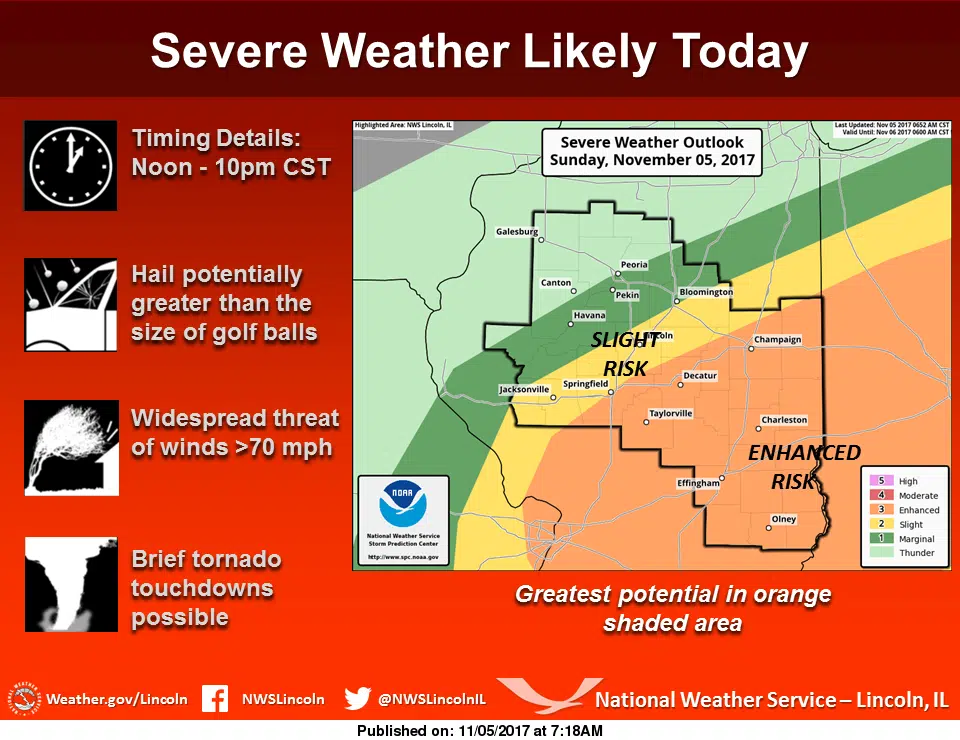
According to the National Weather Service in Lincoln, our entire listening area is under an Enhanced Risk for severe weather today. The National Weather Service stated on their website, “A slow-moving cold front interacting with an unseasonably warm and humid air mass to the south will set the stage for severe weather across much of central and southeast Illinois today. With the frontal boundary now expected to be further south across central Illinois than previously thought, the latest Storm Prediction Center outlook has shifted the Enhanced Risk area further south as well, with the higher probabilities for widespread severe storms now roughly along and south of a Springfield to Hoopeston line. Several clusters of thunderstorms are expected to track across this area today, mainly this afternoon and evening…with very large hail, possibly larger than golf balls in a few locations, along with damaging wind gusts in excess of 70 mph being the main threats. Isolated tornadoes will be possible as well…primarily along and south of the front along the I-70 corridor late this afternoon into early this evening. Areas further north, roughly along and north of a Canton to Peoria line, has seen their severe threat diminish as they will be much further north of the frontal boundary today with any strong storms up in that area posing mainly a hail threat.”
We also spoke with Meteorologist Alan Archer regarding the severe weather threat. Listen to that interview below.
We will continue to update on the weather threat as updates come in.
(Photo courtesy of the National Weather Service in Lincoln.)

