
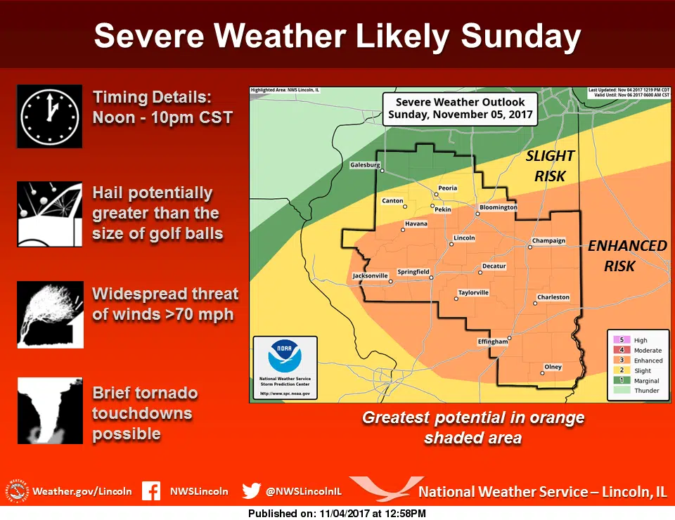
Our listening area will likely see severe weather tomorrow, as the National Weather Service has our area under an Enhanced Risk for severe storms.
The National Weather Service in Lincoln posted an update on our severe risk to their website at 12:58pm on Saturday. Their update stated, “A slow-moving cold front interacting with an unseasonably warm and humid airmass to the south will set the stage for severe weather across much of central and southeast Illinois on Sunday. The latest indications suggest the primary severe weather risk area has shifted southward…impacting locations along and south of a Bloomington to Rushville line. Several clusters of thunderstorms are expected to track across this area Sunday afternoon and evening…with very large hail possibly larger than golf balls in a few locations and damaging wind gusts in excess of 70mph being the main threats. Isolated tornadoes will be possible as well…primarily along and south of the front along the I-70 corridor.”
We will update this story as more information becomes available.
(Photo courtesy of the National Weather Service in Lincoln).

